Wednesday, March 06. 2013
Wind Energy
-----
Belgium has plans for an artificial “energy atoll” to store excess wind power in the North Sea.

This illustration shows how the artificial island would use pumped hydro energy storage where water is pumped to a reservoir during off-peak times and released to a lower reservoir later to generate electricity.
Perhaps it’s not surprising that people from countries with experience holding back the sea see the potential of building an artificial island to store wind energy.
Belgian cabinet member, Johan Vande Lanotte, has introduced a planning proposal for a man-made atoll placed in the North Sea to store energy.
The idea is to place the island a few kilometers off shore near a wind farm, according to Vande Lanotte’s office. When the wind farm produces excess energy for the local electricity grid, such as off-peak times in the overnight hours, the island will store the energy and release it later during peak times.
It would use the oldest and most cost-effective bulk energy storage there is: pumped hydro. During off-peak times, power from the turbines would pump water up 15 meters to a reservoir. To generate electricity during peak times, the water is released to turn a generator, according to a representative.
The Belgian government doesn’t propose building the facility itself and would rely on private industry instead. But there is sufficient interest in energy storage that it should be part of planning exercises and weighed against other activities in the North Sea, the representative said. It would be placed three kilometers offshore and be 2.4 kilometers wide, according to a drawing provided by Vande Lanotte’s office.
The plan underscores some of the challenges associated with energy storage for the electricity grid. Pumped hydro, which contributes a significant portion of energy supply in certain countries, is by far the cheapest form of multi-hour energy storage. It costs about $100 per kilowatt-hour, a fraction of batteries, flywheels, and other methods, according to the Electricity Storage Association. (See a cost comparison chart here.) And grid storage is a considered critical to using intermittent solar and wind power more widely.
The idea of using an “energy atoll” may seen outlandish on the surface, but it’s really not, says Haresh Kamath, program manager for energy storage at the Electric Power Research Institute (EPRI). This approach, first proposed by a Dutch company, uses cheap materials—water and dirt. On the other hand, the engineering challenges of building in the ocean and technical issues, such as using salt water with a generator, are significant.
“It’s not totally crazy—it’s within the realm of reason. The question isn’t whether we can do it,” he says. “It’s whether it makes sense and that’s the thing that needs further studies and understanding.”
Friday, January 18. 2013
The Cloud Machine A Personalized Weather Modification Prototype

While airship construction is not generally within the purview of media artists, a recent project by Karolina Sobecka makes a compelling case for floating personalized weather modification devices up towards the stratosphere. The Cloud Machine is a composite weather balloon and rudimentary cloud seeding apparatus that can create small clouds and make subtle alterations to the atmosphere in the process.
More about it on Creative Applications.
Related Links:
Tuesday, January 15. 2013
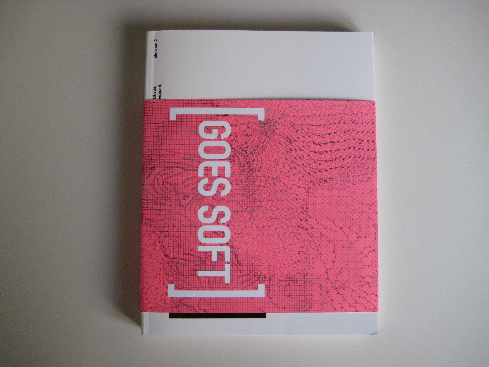
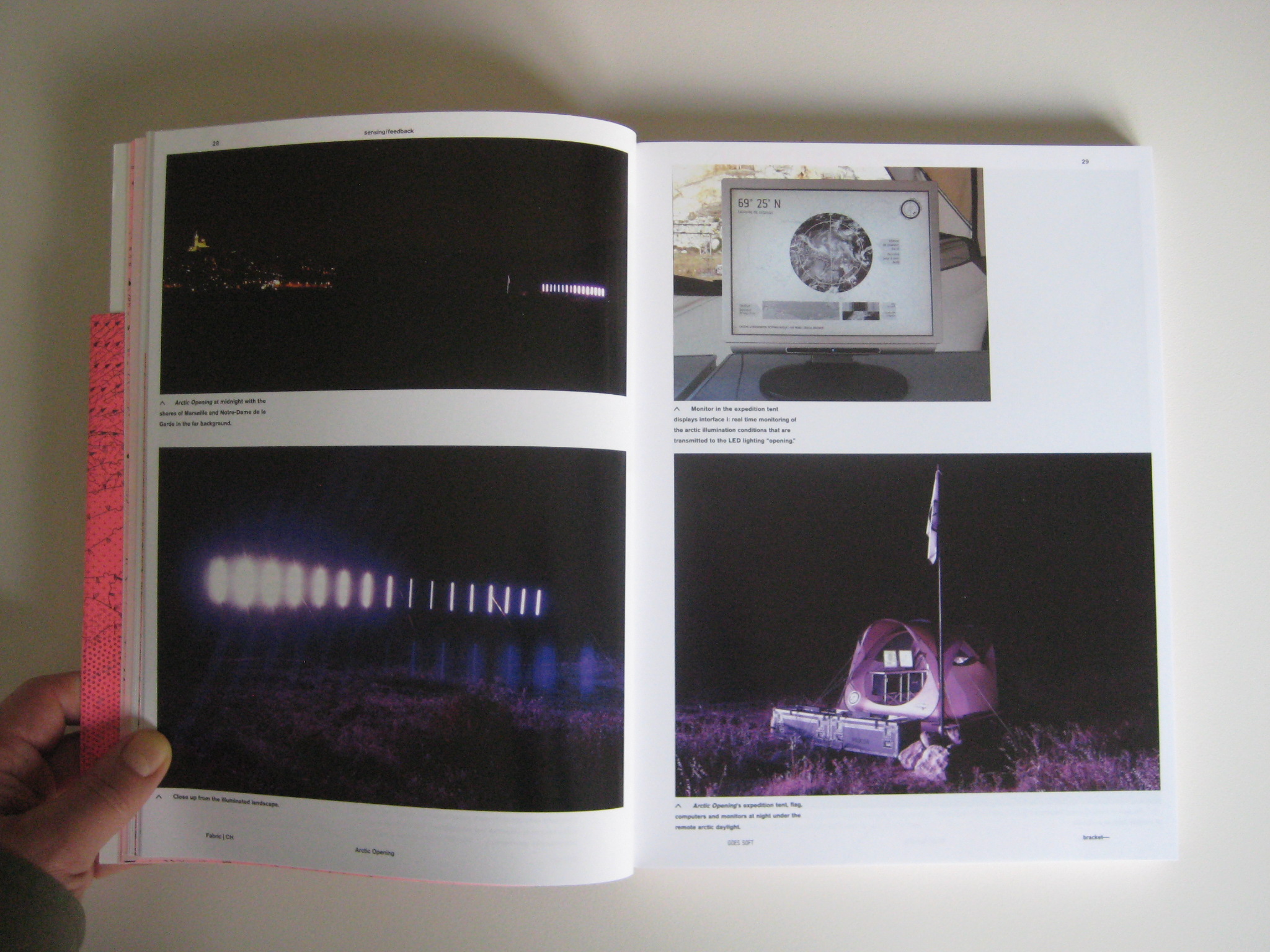
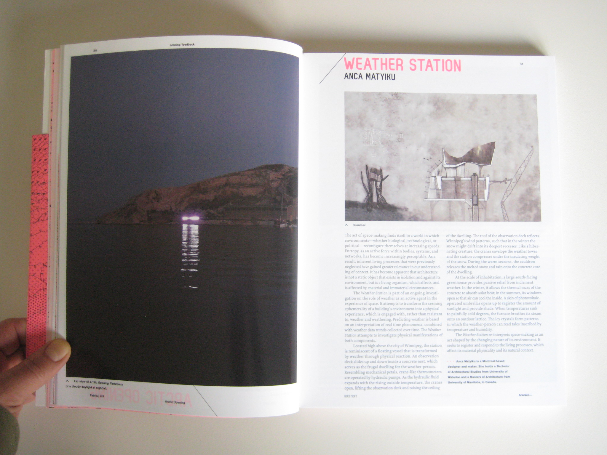
"Arctic Opening, by fabric | ch", Bracket [Goes Soft] (ed. N. Bhatia, L. Sheppard), Actar (New York, 2013)


Friday, December 21. 2012
A portrait of Earths dirty atmosphere
Via ExtremTech
-----

Here’s a mind-blowing view of the Earth that you’ve probably never seen — or even thought of — before. Dubbed “Portrait of Global Aerosols” by NASA, this is the kind of imagery that climate scientists use to analyze the Earth’s atmosphere, the weather, and trends such as global climate change.
Now, first things first: The Earth doesn’t actually look like this from space (alas). Rather, this is an image output by the Goddard Earth Observation System Model, version 5 (GEOS-5). GEOS-5 is an almighty piece of software that runs on a supercomputer at NASA’s Center for Climate Simulation in Maryland.
In the case of this image, GEOS-5 is modeling the presence of aerosols (solid or liquid particles suspended in gas) across the Earth’s atmosphere. Each of the colors represents a different aerosol: Red is dust (swept up from deserts, like the Sahara); Blue is sea salt, swirling inside cyclones; Green is smoke from forest fires; and white is sulfates, which bubble forth from volcanoes — and from burning fossil fuels. The full-size version of the image is particularly mesmerizing, with beautiful swirls of Saharan sand in the Atlantic, and perhaps the tail end of the Gulf Stream circling around Iceland.
It’s hard to be certain, but it seems like the US east coast, central Europe, and east Asia are burning a lot of fossil fuels. Japan, of course, sits on the edge of the Pacific Ring of Fire, so the sulfates there could be from volcanoes. The smoke in Australia is probably from forest fires — but the large volume of smoke from the Amazon rain forest and sub-Saharan Africa is curious. Are these forest fires, or the large-scale burning of wood for heat and power?

As you can imagine, the amount of raw data required to produce such imagery is immense. Weather modeling is still one of the primary uses of supercomputers. To create the Portrait of Global Aerosols, GEOS-5 will have aggregated the measurements from hundreds of weather stations across Earth, along with data from the four NASA/NOAA GOES weather satellites. So you have some idea of the complexity of the GEOS-5 model, the resolution of this image is 10 kilometers (6 miles) — meaning the Earth has been split into regions (“pixels”) of 10km2, and then the atmospheric conditions are simulated for each region. The surface area of the Earth is 510,072,000km2, which means the total number of regions is around 5 million.
Each of these 5 million pixels might have megabytes or gigabytes of weather data associated with it — and of course, in any given area, the weather in each pixel interacts with those around it. This gives you some idea of how much data needs to be processed and moved around — and it only becomes exponentially more complex as sensors improve (producing more data) and as you increase the depth of your analysis. In the case of climate change, for example, scientists are modeling decades or even centuries of data to try and divine some kind of pattern — a task that taxes even the most powerful supercomputers. If you’ve ever wondered why we keep building faster and faster supercomputers, now you know why.
Now read: What can you actually do with a supercomputer?
Tuesday, December 04. 2012
The Coldscape
Via Cabinet
-----
By Nicola Twilley
More than three-quarters of the food consumed in the United States today is processed, packaged, shipped, stored, and sold under artificial refrigeration. The shiny, humming stainless steel box in your kitchen is just the tip of the iceberg, so to speak—a tiny fragment of the vast global network of temperature-controlled storage and distribution warehouses cumulatively capable of hosting uncounted billions of cubic feet of chilled flesh, fish, or fruit. Add to that an equally vast and immeasurable volume of thermally controlled space in the form of shipping containers, wine cellars, floating fish factories, international seed banks, meat-aging lockers, and livestock semen storage, and it becomes clear that the evolving architecture of coldspace is as ubiquitous as it is varied, as essential as it is overlooked.
(...)
More about it and about a "perpetual winter" on Cabinet's website.
Related Links:
Monday, November 05. 2012
Geoengineering Could Be Essential to Reducing the Risk of Climate Change
-----
Using technology to cool the planet may be the only way to deal with the greenhouse gases already in the atmosphere, argues scientist David Keith.
By Kevin Bullis

David Keith spoke at MIT Technology Review’s EmTech conference this week.
Geoengineering—using technology to purposefully change the climate—is the only option for reducing the risk of climate change from greenhouse-gas emissions in the next few decades, says David Keith, a professor of public policy and applied physics at Harvard University. And he says that if it’s done in moderation, it could be much safer than some experts have argued. In fact, says Keith, effective methods of geoengineering are so cheap and easy that just about any country could do it—for better or worse.
Keith, speaking this week at MIT Technology Review’s annual EmTech conference, says it is already too late to avoid climate changes by reducing carbon emissions alone. The carbon dioxide that’s been released into the atmosphere by burning fossil fuels is already likely to cause significant harm, such as raising temperatures enough to hurt crop yields in many places. “If you want to, say, really stop the loss of Arctic sea ice or stop heat-stress crop losses over the next few decades, geoengineering is pretty much the only thing you can do,” he says (see “Why Climate Scientists Support Geoengineering Research”).
One of the main objections to geoengineering is that the measures that might be taken to cool the planet won’t exactly offset the effects of carbon dioxide, so they could actually make things much worse—for example, by altering patterns of precipitation. Keith says recent climate models suggest that injecting sulfate particles into the upper reaches of the atmosphere might not affect precipitation nearly as much as others have warned.
“I propose that you start in about 2020, and you start very, very gradually increasing your amount of sulfate engineering so that you cut about in half the rate of warming,” he says. “Not eliminate it, but cut it about in half. Cutting it in half is a big benefit.”
One of the benefits could be increased crop production. Though some critics have worried that geoengineering would alter monsoon patterns that are key to agriculture in India, Keith says moderate geoengineering could actually boost crop productivity there by 20 percent, in part by reducing temperatures.
Keith and some of his colleagues recently hired engineers to estimate how much one approach to sulfate injection might work, and how much it might cost. It could be done at first with existing airplanes—certain business jets can fly high enough to inject the particles into the upper atmosphere. Eventually we would need new planes that can fly higher. All in all, once the procedure is scaled up it would cost about a billion dollars a year and require about 100 aircraft. That’s cheap enough for most countries to pull off on their own.
The fact that it’s easy isn’t necessarily a good thing, Keith says. There’s the potential that if one country does it, another might blame that country—rightly or wrongly—for ensuing bad weather (see “The Geoengineering Gambit”).
And there are also real concerns about the impact sulfates might have on the atmosphere (see Geoengineering May Be Necessary, Despite Its Perils). It’s known that sulfates can be involved in reactions that deplete the ozone layer. As the earth warms, water vapor levels are increasing, which could exacerbate the problem. Keith is proposing a test to discover quantitatively just what the effect of the injections could be. He would introduce small clouds of sulfate and water vapor into the stratosphere using balloons, and then carefully measure the reactions that take place.
And Keith acknowledges a concern many have had about geoengineering: that using it to offset problems from climate change will reduce the incentive to tackle the greenhouse-gas emissions at the root of the problem. Even if geoengineering is employed, reducing emissions will still be important. Sulfate injection does nothing to address the ocean acidification associated with increased levels of carbon dioxide in the atmosphere. And if emissions continue to grow, ever-increasing amounts of sulfate will be needed.
But Keith thinks the potential benefits might be worth the dangers. “We don’t know enough yet to start,” he says. “But the current balance of evidence is that doing this really would reduce risks. And for that reason, we’ve got to take it seriously. It really would be reckless not to look at something that could reduce risk like this could.”
Thursday, September 13. 2012
Showtime: Google Street View Trekker
How Google Builds Its Mapsand What It Means for the Future of Everything
It's common when we discuss the future of maps to reference the Borgesian dream of a 1:1 map of the entire world. It seems like a ridiculous notion that we would need a complete representation of the world when we already have the world itself. But to take scholar Nathan Jurgenson's conception of augmented reality seriously, we would have to believe that every physical space is, in his words, "interpenetrated" with information. All physical spaces already are also informational spaces.
-
Read the full press article on theatlantic.com
Personal comment:
Interesting point by author A. C. Madrigal in his article to consider the Google driverless cars as the coming "web crawlers" of the physical world ... Interesting also, the concept of "deep map".
Additionnal comment on this post (01.10.2012), even more interesting now that we see Google driverless cars getting legalized in California...
Saturday, September 01. 2012
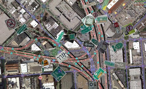
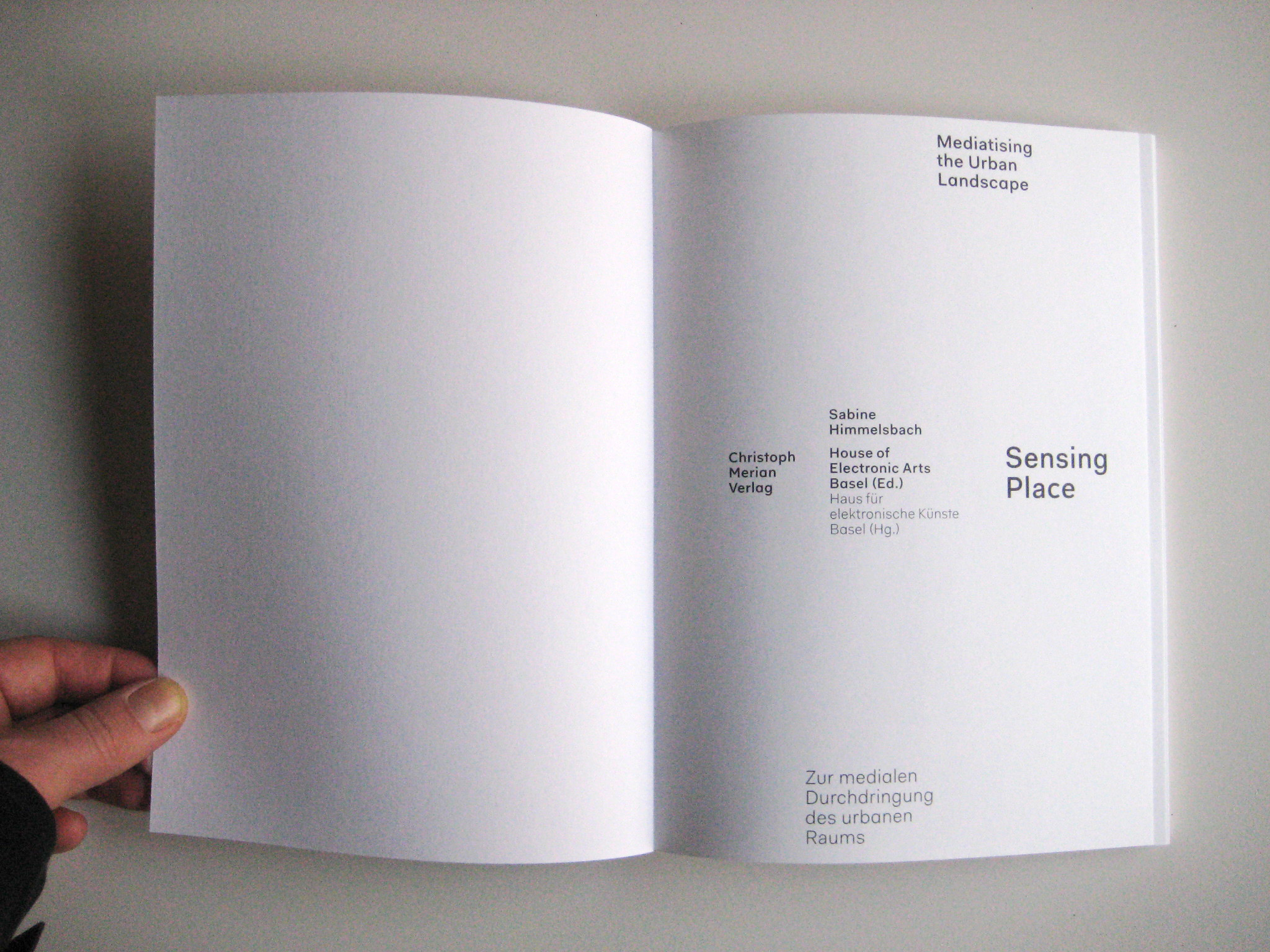
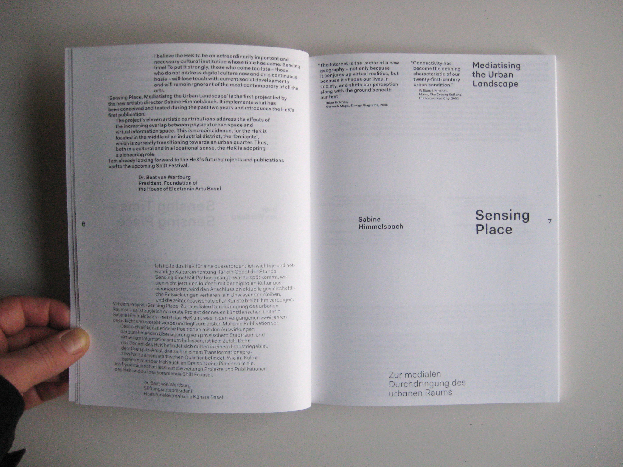
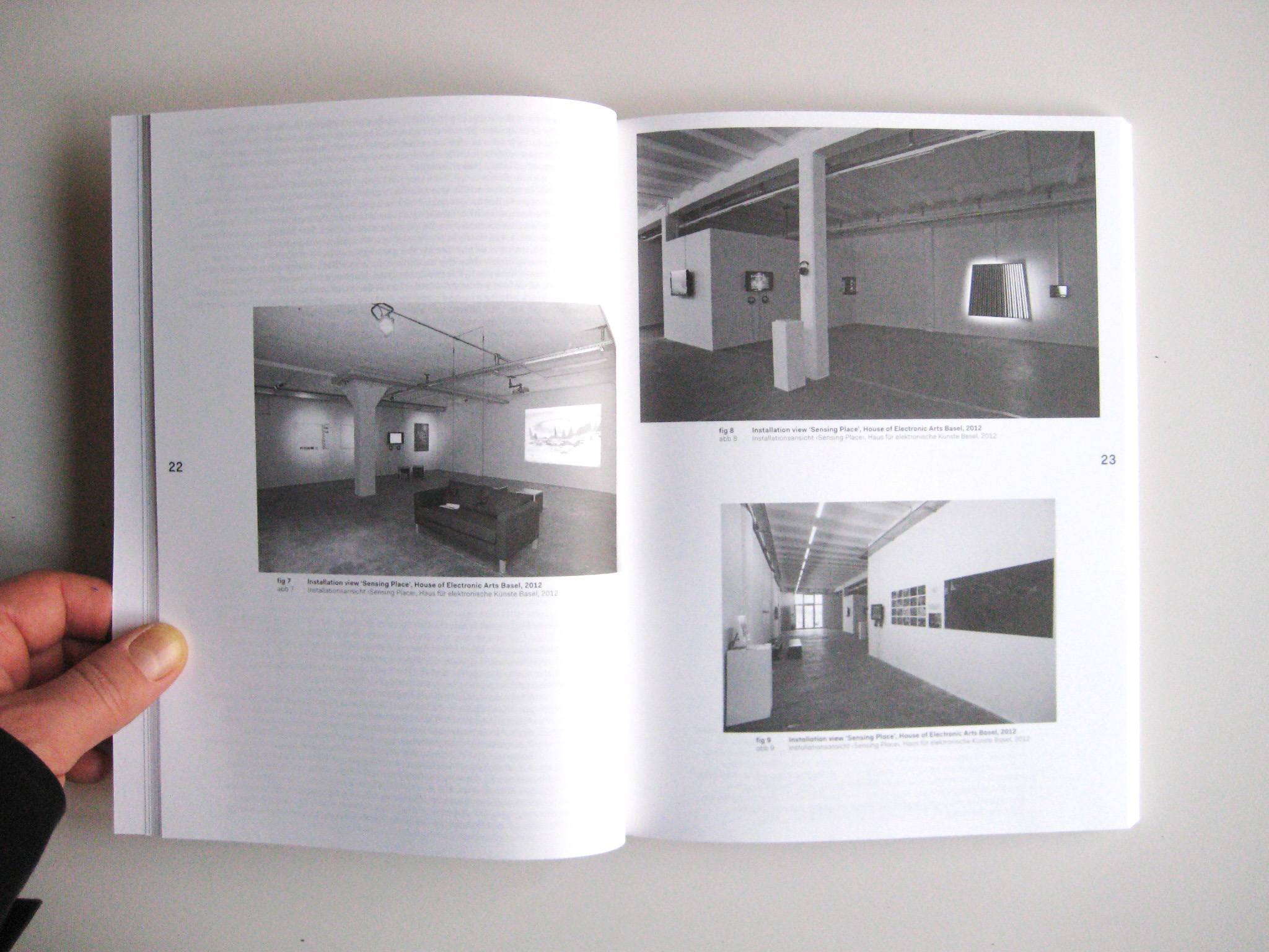
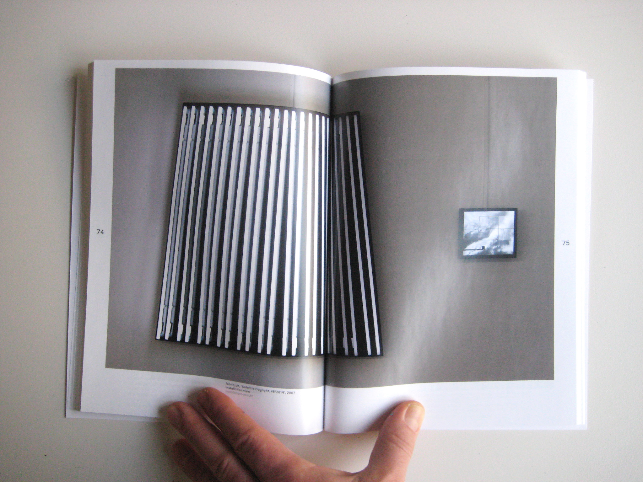
"fabric | ch Satellite Daylight 46°28'N", Sensing Place (ed. S. Himmelsbach), Merian Verlag (BAsel, 2011)


Wednesday, December 07. 2011
The Rounds
Via BLDGBLOG
-----
(...)
5) "Imagine a lush forest: silent but for the chirping of birds flying through a dense canopy overhead, and damp, aromatic earth underfoot. Now picture a mountain of incinerated trash, 12 million tons of what was once a toxic heap of rotting fish and vegetables, old clothes, broken furniture, diapers and all manner of discarded items." This describes a new project by architect Tadao Ando called the Sea Forest. The Sea Forest "will transform 88 hectares of reclaimed land, a 30-meter deep mound of alternating layers of landfill, into a dense forest of nearly half a million trees" in Tokyo Bay. Ando adds that it is also an experiment in climate-engineering, or weather control as the future of urban design: "not only will [the forest] become a refreshing retreat for stressed out city workers, it will also create a cool ocean breeze to sweep through the capital and cool its sweaty denizens in summer."

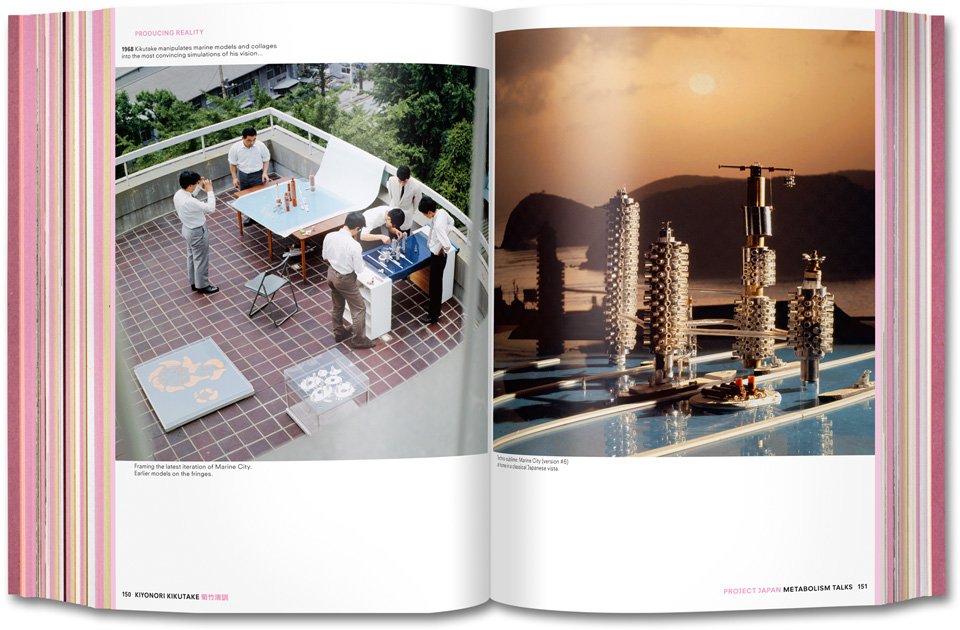


 [Images: Spreads from Project Japan, courtesy of Taschen].
6) The new book Project Japan by Rem Koolhaas and Hans Ulrich Obrist is an incredible document, in both physical and intellectual terms. The design, by Irma Boom, is gorgeous, and the contents—consisting of long, illustrated interviews with such figures as Arata Isozaki, Kenzo Tange's Tange Lab, Kiyonori Kikutake, Kisho Kurokawa, and many others, scattered amongst historical imagery and present-day site photos—offer a fascinating oral history of the Metabolist movement. As Koolhaas sums it up, Metabolism offered "a manifesto for the total transformation of the country" based on three specific principles. Still quoting Koolhaas:
a) The archipelago has run out of space: mostly mountainous, the surfaces fit for settlement are subdivided in microscopic, centuries old patchworks of ownership
b) Earthquakes and tsunamis make all construction precarious; urban concentrations such as Tokyo and Osaka are susceptible to potentially devastating wipeouts [ed. note: cf. today's calls for a "back-up Tokyo"]
c) Modern technology and design offer possibilities for transcending Japan's structural weakness, but only if they are mobilized systematically, almost militaristically, searching for solutions in every direction: on the land, on the sea, in the air...
Architecture thus becomes the literal geopolitical extension of the state, constructing new territory—such as floating forests and artificial islands—over which to govern. It's a kind of proactive gerrymandering, we might say: not redesigning the district map, but constructing new districts. In any case, I recommend the book.
(...)
Related Links:
fabric | rblg
This blog is the survey website of fabric | ch - studio for architecture, interaction and research.
We curate and reblog articles, researches, writings, exhibitions and projects that we notice and find interesting during our everyday practice and readings.
Most articles concern the intertwined fields of architecture, territory, art, interaction design, thinking and science. From time to time, we also publish documentation about our own work and research, immersed among these related resources and inspirations.
This website is used by fabric | ch as archive, references and resources. It is shared with all those interested in the same topics as we are, in the hope that they will also find valuable references and content in it.
Quicksearch
Categories
Calendar
|
|
April '24 | |||||
| Mon | Tue | Wed | Thu | Fri | Sat | Sun |
| 1 | 2 | 3 | 4 | 5 | 6 | 7 |
| 8 | 9 | 10 | 11 | 12 | 13 | 14 |
| 15 | 16 | 17 | 18 | 19 | 20 | 21 |
| 22 | 23 | 24 | 25 | 26 | 27 | 28 |
| 29 | 30 | |||||
